 |
| White-sided dolphins visited Comocean as we left Punta Chivato. |

Isla
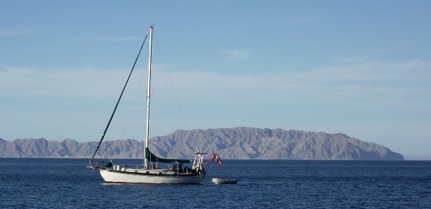
On March 30th we anchored at Isla San Marcos. According to our cruiser guide by Breeding and Bansmer, San Marcos
 |
| Anchorage at south end of Isla San Marcos |

 |
| Flocks of eared grebes were frequently seen. |
 |
| Gypsum vein. |
 |
| Gypsum crystals. |
 |
| Isla San Marcos gypsum open pit mine. |


Either someone had a sense of humor or this was their version of a restroom for those waiting for the next panga - much nicer than a hole in the ground.

Thar she blows!
Every morning Sea of Cortez sailors force themselves to get out of the sack and turn on their SSB radios and tune to either (or both) Sonrisanet (Geary) or Amigonet (Don) to get the day’s weather forecast. Quite honestly I don’t know why we bother. They use most of the same resources (I don’t think they use the same weather models though) and sometimes they agree, but a lot of the time they don’t. Most of the time they are close, but sometimes they are really wrong! The weather gods are so damn whimsical. One guy doesn’t even recognize wind under 25 knots. We like to put in a reef at 18, so under 25 is significant to us. We live by their forecasts, deciding whether to stay or go, go north or south, reef or not. Geary and Don will be the first to say that the Sea of Cortez has a lot of micro climates and the winds change as you go from west to east. Yes - but with all the technology you would think their forecasts might be a little more dependable.
After a brief stay in Santa Rosalia for provisioning we decided to head north towards Bahia de Los Angeles and the Midriff Islands. Our first anchorage was Bahia San Francisquito. Somewhere along the way, I can't remember where (I am past 60 now and I didn't write it down) we saw our first whales. About 20 feet from our port side we saw black "whale hide" rising above the water, then a pyramidal dorsal fin. Then a second larger fin surfaced behind the smaller one; momma was joining her calf. This went on for a few minutes with bits of whale rising above the water and then sinking, and then the large flukes pointed at the sky and she dove. We didn't get pictures but we immediately grabbed the ID book to identify what we had seen. Of course nothing matched. We shared our experience with other cruisers that have been in the Sea for many seasons and they felt that we had seen a sperm whale. The idea of being next to such a large animal was astounding. We were in 2,000-3,000 ft deep water and there are Humbolt squid (sperm whale's favorite food) so it was possible.
We where in San Francisquito with another boat, Warren Peace, and based on a favorable forecast we
 |
| Warren Peace out of the storm. |
 |
| Pelicans are abundant in the Sea of Cortez. |
 |
| Pelicans in the storm. |
 |
| Rain over the channel. |
It wasn’t long before we were sailing under sunny skies again. As for the "favorable forecast", we had high winds off and on throughout the day. Our highest recorded gust was a whopping 69.9 knots!!


 |
| Baja coast north of Bahia San Francisquito. |
 |
| The Baja coast reflects its geologic past and mineral riches. |
I was so excited by our next anchorage even though it had a name that didn't roll of the tongue: Cala Puertocito (little port) de Enmedio. The scenery was beautiful and the birds were abundant. Best of all, I could hear whales. After sunset I sat on the deck for an hour watching six whales spout and listening to them exhale and inhale. They where just cruising around right outside of this little cove.

Around midnight the swell started entering the anchorage and rocking the boat. Things started to fly off the counter tops and all hell broke loose. We had never been shaken so badly in all of our passages. Sleep was out of the question and we couldn't leave soon enough. As soon as the sky lightened we pulled anchor.
We anchored off of Punta Soldado, north of Animas Bay. When I noticed a sizable lagoon on the chart, being the lagoon junky that I am, I convinced Greg that we should go back south a little bit and visit Punta Islotes in the southern portion of Bahia de Las Animas.
 |
| A coyote visits the beach in the evening. |
There weren't many birds, but it was a lovely lagoon. At first Greg wanted to turn around and skip the lagoon because of a large group camped nexty to it. As we beached the dinghy a gentleman from the group approached us. The group of over a hundred people where from Dana Hills High School in California. They were seniors from the school's marine ecology class. Their teacher brings his students down every year so that they can apply what they have learned. I thought that this was absolutely terrific. Randy, the teacher, knows the area well because he has a vacation home in Bahia de Los Angeles and has been coming to Baja Sur for the last 38 years.
 |
| Marine Ecoloby camp in Bahia de Los Animas. |
 The elegant tern is a Mexican bird which we see frequently but only got a good photo of it at this lagoon. It doesn't enter the water like pelicans or gulls, it just skims over the water and grabs its fish. If you watch closely you can see it do a little shimmy between wing beats to shake off water.


 This pair of ospreys were nesting on top of a small island. These are the first ospreys that we have seen that aren't on top of a utility pole.
 The reddish egret was the only bird in the lagoon while we were there. It has an unusual beak that is dark at the tip and lighter towards the eye.

 |
| Anchored at Punta Islotes |
 |
| Lagoon inlet. |

There isn't much vegetation around this lagoon. Little fiddler crabs of various colors covered the shore. It was next to impossible not to step on them. There were red ones, yellow and my favorite a lavendar one.
This pair of ospreys were nesting on top of a small island. These are the first ospreys that we have seen that aren't on top of a utility pole. The reddish egret was the only bird in the lagoon while we were there. It has an unusual beak that is dark at the tip and lighter towards the eye.
We met up with our friends on Warren Peace a few days later and continued going north.
 |
| Lagoon outflow with Comocean in the distance. |
No comments:
Post a Comment